


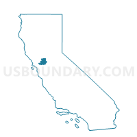
Voting District 30311, Solano County, California
About
Outline

Summary
| Unique Area Identifier | 544529 |
| Name | Voting District 30311 |
| County | Solano County |
| State | California |
| Area (square miles) | 0.62 |
| Land Area (square miles) | 0.62 |
| Water Area (square miles) | 0.00 |
| % of Land Area | 99.79 |
| % of Water Area | 0.21 |
| Latitude of the Internal Point | 38.25802170 |
| Longtitude of the Internal Point | -121.97783020 |
Maps


Graphs
Select a template below for downloading or customizing gragh for Voting District 30311, Solano County, California


Neighbors
Neighoring Voting District (by Name) Neighboring Voting District on the Map
- Voting District 30310, Solano County, CA
- Voting District 30315, Solano County, CA
- Voting District 30330, Solano County, CA
- Voting District 40850, Solano County, CA
- Voting District 40855, Solano County, CA
- Voting District 51205, Solano County, CA
- Voting District 51254, Solano County, CA
Top 10 Neighboring County Subdivision (by Population) Neighboring County Subdivision on the Map
Top 10 Neighboring Place (by Population) Neighboring Place on the Map
Top 10 Neighboring Unified School District (by Population) Neighboring Unified School District on the Map
Top 10 Neighboring State Legislative District Lower Chamber (by Population) Neighboring State Legislative District Lower Chamber on the Map
Top 10 Neighboring State Legislative District Upper Chamber (by Population) Neighboring State Legislative District Upper Chamber on the Map
Top 10 Neighboring 111th Congressional District (by Population) Neighboring 111th Congressional District on the Map
Top 10 Neighboring Census Tract (by Population) Neighboring Census Tract on the Map
- Census Tract 2523.17, Solano County, CA (6,823)
- Census Tract 2527.07, Solano County, CA (4,753)
- Census Tract 2527.06, Solano County, CA (3,844)
- Census Tract 2528.02, Solano County, CA (1,359)
- Census Tract 9800, Solano County, CA (16)